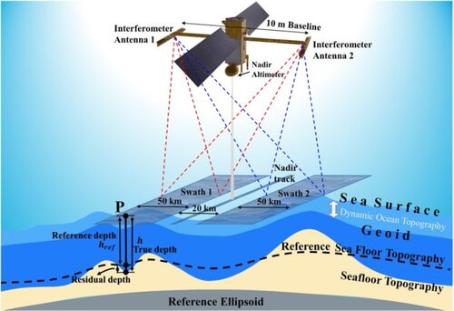
The SWOT satellite was launched on December 15, 2022, into an orbit 891 km above sea level from Vandenberg AFB in the United States.
SWOT (Surface Water Ocean Topography) is an Earth observation satellite responsible for measuring the level of surface waters - lakes, reservoirs and rivers -, their width and estimating through these variables the flow of major rivers, as well as determining in a very fine and accurate way the level of oceans and seas.
The project was developed between CNES, NASA, Thales Alenia and CNRS, with support from the UK and Canadian space agencies, and will last at least five years.
The satellite will screen the topography of 90 percent of the world’s water surfaces, a scale never before achieved.

These measurements should lead to a better understanding of the water cycle and better control of water resources that have become critical, as well as refine our knowledge of ocean circulation to improve climate models.
For more information
Online seminar Altimetry - from metrology to climatology

